Category Archives: Stations

Around Mac Town

20151030-IMG_2802-2
Ross Island dominated by Mt. Erebus in the center as seen from out on the ice shelf. McMurdo and Scott Base are located on the dark area to the left.

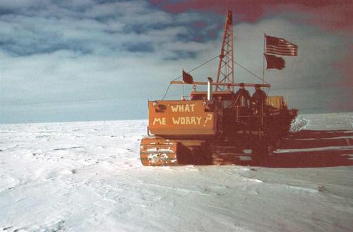
The weather in Antarctica is notoriously capricious, especially in the stormy West Antarctic, and its storms are legendary. Teams heading out to the “Deep Field” are brought into McMurdo several weeks in advance to complete training and preparations for the field, but also to give a buffer for deployment to field sites. Weather delays of a week, or two, or three are not uncommon especially when combined with ageing aircraft and shifting priorities with many groups needing to utilize flights. Once field preparations are complete we volunteer with other departments and projects and take advantage of the hikes and activities offered around the main USAP hub of operations. It can be frustrating at times to have clearly defined projects and goals and not be able to start. On the other hand most deep field camps are on the bright flat white so the majestic mountain views, hiking trails, and wildlife are savored while amenities like hot showers and warm dark rooms are appreciated. I wrote a post about McMurdo back in 2012 – not too much has changed : ) Check it out here: antarcticarctic.wordpress.com/mcmurdo-station-aka-mac-town and another here: antarcticarctic.wordpress.com/2014/11/10

CRREL: This year I’ve spent a fair bit of time assisting some friends with the Cold Regions Research and Engineer Laboratory (CRREL) as they conduct ground penetrating radar (GPR) and GPS surveys of the McMurdo area. One project is looking at the structure of the McMurdo ice shelf. With the airfields and runways built out on the flat ice it is an integral part of USAP logistics and would pose a huge problem should a large piece calve away unexpectedly. To do the survey we towed 200MHz and 400MHz GPR devices behind snowmobiles along predetermined transects using a precision Trimble GPS unit to record location and elevation. Ice cores were manually collected to determining the depth of the brine layer – essentially the ice depth at specific points. The cores ranged from 5-16 meters deep!
The sea ice, which may break up during the summer, is roughly 1-7m thick, while the ice shelf which remains frozen year-round reached depths of greater than 40m!

Another project was examining the geology and bedrock structure of the McMurdo area in town. While there are still significant patches of ice and snow it’s starting to melt out and most of the roads are clear by now. We made an amusing sight: one person in the lead with a rope around their waist dragging a bright pink plastic sled loaded with a big orange box along the gritty uneven rock roads and hillsides…the other person walking next to the sled wearing a yellow backpack with a big antenna sticking out the top.

SPOT: The South Pole Traverse is heading out around this time of year too so there is a lot to do to help them get cleaned up and on the ‘road’ to Pole. I spent several days helping the SPOT teams reorganizing drums and securing cargo to their sleds. While their set-up is much larger and more complicated than ours will be, the theory is all the same and it was good to re-familiarize myself with the Cat Challengers, though the ones we will be using at WAIS are far older and a bit smaller. See my previous post for more information on SPOT: Antarcticarctic.wordpress.com/spot

Dive Tending: One morning I got to assist the Divers. On that particular day they were recording water column visibility along a steep drop-off not far from the station. We met in town and loaded up a Pisten Bully with all their gear and supplies. Out on the ice we stopped at one of the “Fish Huts.” Small brightly colored buildings, the heated huts sit over maintained holes in the ice at designated dive points. Bundled up in long underwear, a full insulated down suit, and a sturdy dry-suit the two divers were uncomfortably warm while we got everything ready. Gear was brought inside the hut and a line was tied off to the hut wall and then lowered into the water with strobes, flags, and an emergency air tank. In the dim light under the ice and with very limited places to surface it is imperative not to lose the dive hole! Then sitting at the edge of the hole, with practiced efficiency, they pulled on their hoods and masks, strapped on their weights and flippers, locked on their thick lobster-claw mittens, and hoisted on their air tanks and regulators…and then they slipped into the hole!

McMurdo_Sound#Life_below_the_ice

With a burst of bubbles they sank down the 3-4ft hole through the sea ice and disappeared into the dark water. Once they were gone I lowered the ladder and closed the shutters of the hut. The sunlight filtering through made the ice glow an electric blue around the black water. The dive lasted about 20 or 30 minutes as I watched from above noting feathers, or platelets, of ice growing on the surface of the ~28F water and keeping an eye out for the divers as they swam under the hole.

IMG_3039

The second diver about to enter the water

Before I knew it there was a mass of bubbles and one of the divers appeared in the hole. I assisted with hauling out their heavy air tanks so they could climb the ladder and warm up next to the stove. Then it was back to town in time for lunch!

IMG_3060

Pressure Ridge: An interesting feature in the McMurdo area is the pressure ridge. An area of ice that’s been forced together by ice flow and tidal movement it forms each year right in front of New Zealand’s Scott Base. With unrelenting pressure the ice is driven into the air cracking and breaking to form stunning features – the snow bright white and the ice glowing a deep blue. With so much relative ice movement thin spot and air holes form making it very popular with the Weddell seals in the area.

A friend’s website with some amazing photography of pressure ridges and more can be found here: www.benadkisonphotography.com/antarctica

Ob Tube: The Observation Tube (aka Ob Tube) offers a unique glimpse under the sea ice just in front of McMurdo. A tube, anchored to the ice surface, houses a ladder down 10ft or so to the base where there is a small round area with windows. Not for the claustrophobic, it is a tight fit and is quite dark. Some light filters through the ice to illuminate sea stars on the ocean floor while tiny fish, jelly fish, and pteropod “Sea Angels” float past the thick ice rimmed windows. Perhaps most notable is the texture of the sea ice base. While the top of the sea ice is a varied terrain of snow, blue ice scoured clear, or area of melt later in the summer, the base is comprised of delicate sheets and leaves of ice called platelet ice. The seawater is below freezing here at ~28-29F on average and as the fresh water freezes a salty shimmering brine solution is formed just below the ice level.
Later in the summer the ice will thin and possibly break up here so the Ob tube is a temporary feature only deployed for a few weeks in November.

Check out this post from a fellow polie about the Ob Tube here: http://davidpablocohn.com/ob-tube

Arrival Heights: Arrival Heights is an area just Northeast of McMurdo Station proper, not far from the Castle Rock hiking loop trail. It is an area reserved for clean air sampling and radio and light sensitive experiments – a bit like Summit’s Clean Air Sector and South Pole Dark Sector combined. Several special camera suites study auroras so in the winter the use of lights is kept to a strict minimum. Other experiments are looking at the ionosphere and magnetosphere (space weather) utilizing huge antenna arrays which are highly sensitive to radio transmissions.

As an Antarctic Specially Protected Area (ASPA) it is off limits to the public at large, however occasional guests are permitted as long as they are accompanied by official personnel and traffic, either by foot or vehicle, is limited to designated routes only.
Exposed to some brutal winds it also offers one of the most beautiful views with the Royal Society Mountain Range clearly visible to the West and unhindered views North towards Cape Evans and the sea ice edge.


Cape Evans:
About 20km North of McMurdo Station on Ross Island is Cape Evans. Named for Robert Falcon Scott’s second-in-command Lieutenant Edward Evans it was the staging point for the British Terra Nova Expedition of 1910-1913 .
The expedition’s hut, now dubbed Scott’s Hut, was prefabricated in England and reconstructed on Cape Evans in 1911. It was built to house the 25 men of the expedition during the following winter while they prepared for the journey inland. With lessons learned from Scott’s previous, and frigid, Discovery Hut (located on Hut Point, just a short walk from McMurdo Station and used by Scott during the 1901-04 Discovery Expedition) the 1911 Cape Evans hut contains two stoves, better insulation, and is surrounded on some sides by a covered stable and storage area. Some of the men reported that it was “warm to the point of being uncomfortable.”
In the austral spring of 1911 Scott and several of his men set out to be the first men to reach the South Pole. For more information on that check out this fantastic 2011 article Race to the South Pole by the National Geographic. They arrived on January 17, 1912 to find a tent and a note from Roald Amundsen who had reached the South Pole first on December 14, 1911. Their dreams dashed, they headed towards the coast, however suffering from malnutrition and cold injuries there were no survivors.

This is of particular historic significance as it was this brutal expedition that arrived at the South Pole (just behind Norwegian Roald Amundsen) and from which Scott never returned. Several men remained at Scott’s Hut for the winter of 1912 to search for Scott’s party, however in 1913 they left Antarctica as well, leaving Scott Hut stocked with supplies.

The Hut was used again in 1915-17 by 10 men from Ernest Shackleton’s Ross Sea party after their ship, the Aurora, with the rest of the crew, broke adrift and was taken North in the ice in May 1915. The Ross Sea party was the counterpart to Shackleton’s 1914-17 Imperial Trans-Antarctic Expedition expedition, the ill-fated attempt to cross the continent. They were responsible for laying supply depots for Shackleton’s return from the Pole, however Shackleton trapped in the ice aboard the Endurance, failed to ever reach the continent itself and so the entire effort was for naught.

Due to sub-freezing temperatures, low humidity, and conservation efforts by the US and New Zealand and the Antarctic Heritage Trust both Scott’s Hut and Discovery Hut have remained much as they were left in the early 20th century; Beds are made with shoes tucked beneath, a desiccated and partially dissected penguin lies on a table, glass vials of medicine and solutions line shelves while the kitchen is well stocked with tins and cartons of various food stuffs. A massive pile of seal meat is stacked out in the covered storage area, fairly well preserved for being over a hundred years old, though smelling a bit rancid…The entire site is full of amazing artifacts from the expedition such as snowshoes for their ponies, and cartoons tacked to the wall.

Check out Amusing Planet’s page on Scott’s Hut for more information on the hut’s artifacts and the expedition in general: www.amusingplanet.com/captain-robert-scotts-hut-in-antarctica.html

2 Comments

Filed under Antarctic, McMurdo, Science, Stations

Antarctic Traverses…

There is a long history of traverses in Antarctica. From the original expeditions to explore the mysterious frozen continent and reach the South Pole accomplished via foot, ski, and sledge to the modern day tractor traverse endeavors. One of the first tractor traverses was across West Antarctica from the Little America base to establish Byrd Station during the 1956-57 International Geophysical Polar (IGY) year.

The 1957 Little America to Byrd Traverse!

The 1957 Little America to Byrd Tractor Traverse

1960 Trav

1960-61 Byrd Station to South Pole Traverse (Courtesy of: southpolestation.com/trivia)

In the late 1990s and into the 2000s there was the International Trans-Antarctic Scientific Expedition (ITASE) that covered much of the West Antarctic high routes and along the Transantarctic mountain range. See this link for one of their official informational posters: http://www2.umaine.edu/USITASE/images/poster/poster.jpg

In 2007-08 and 2008-09 the Norwegian-U.S. Scientific Traverse covered much of East Antarctica collecting data on past climate. Since then there have been several more traverses to assist the Pine Island Glacier (PIG) camp and WISSARD project. Last year and this season traverses were used to retrieve cargo left at Pine Island Glacier and Byrd.

For more information on various traverse routes check out the National Ice and Snow Data Center’s map: http://nsidc.org/data/thermap/antarctic_10m_temps/traverses/us.html#map. A list of traverses by date can also be found at the National Snow and Ice Data Center website here: http://nsidc.org/data/thermap/antarctic_10m_temps/dates.html or on Wikipedia at: https://en.wikipedia.org/wiki/List_of_Antarctic_expeditions

There have been a number of traverses in Marie Byrd Land in West Antarctica alone. Experienced Antarctic mountaineer, Forrest McCarthy, wrote a great blog post on Marie Byrd Land exploration and history which can be found here: http://forrestmccarthy.blogspot.com/2012/12/west-antarctica-driving-guide-to-marie.html

While there are a growing number of small tourist/exploration traverses via trucks or ski, most modern traverses support scientific projects that require mobility and various sample sites along the traverse route. Alternatively, some traverses are simply for moving cargo and/or fuel. However counterintuitive, it is much cheaper to drag weight over the snow behind tractors than it is to fly it! Our little traverse this year and the PIG traverse last year fall into this category.

PIG_20141228_337 copy

The PIG-WAIS Traverse leaving Pine Island Glacier during the 2014-15 season

2012-13 Byrd-WAIS-PIG traverse

The Byrd-WAIS-PIG Traverse leaving Byrd in 2012-13

2012-13 Byrd-WAIS-PIG Traverse Fuel

The Byrd-WAIS-PIG Traverse fuel bladders leaving Byrd in 2012-13

Pole Fuel tanks 3

An AN-8 fuel tank at the South Pole

Perhaps the most well-known traverse is the South Pole Overland Traverse (SPOT) that hauls fuel from McMurdo, where it is supplied via ocean tanker, to the South Pole Station. The Antarctic Sun published an article in 2008 covering SPOT which can be found here: antarcticsun.usap.gov/features. All operations down here rely on a low-grade jet fuel. It’s what the LC-130 Hercs and other aircraft burn as well as being close enough to diesel that all our heavy equipment and generators run on it as well. Some additives are added for Antarctic operations to lower the freezing/gelling point – thus the AN-8 or JP-8 terms used.

Fuel drum cache Byrd!

A remote fuel drum cache for aircraft near Byrd

At the South Pole large generators burn this fuel to supply power to the station. The waste heat is captured to melt snow for water and to heat the main station. Heavy equipment is necessary to clear snow from around the buildings and berms, groom the skiway for the planes, and move cargo. It’s vital to supporting science and life down here. They burn over 300,000 gallons annually. Summit Station in Greenland on the other hand, burns only about 40,000 gallons while WAIS Divide (a large deep field camp) goes through roughly 45,000 gallons during the summer season. WAIS burns so much fuel in part because it initially supported a 24/7 deep ice core drilling operation, which required massive generators. Since drilling has ceased they have primarily supported airborne surveys of the region with Twin Otters and Baslers, which also uses significant amounts of fuel.
At the year-round stations the big push in the short summer season is building up the fuel reserve for winter. Ideally 50,000 gallons are on site at Summit Station in Greenland before the end of summer and more than 400,000 gallons at the South Pole station!

Pole Fuel arch2

45 tanks (10,000 gallons each) sit inside one of the arches at the South Pole

Pole Fuel arch3

Looking along the fuel arch at Pole

Pole Fuel tanks

The emergency fuel cache tanks at the end of the world at Pole

A field camp 10,000 gallon bladder at Byrd

A field camp 10,000 gallon bladder at Byrd

Typically, fuel is flown in via Hercs, however this is a terribly inefficient process. I’ve been told various ratios and it depends heavily on winds and cargo loads, but on flights to the Pole Hercs burn between one and three gallons for every gallon delivered. A few years ago the South Pole Traverse was developed as an alternative to supplying fuel to the South Pole.

In Greenland a similar operation called the Greenland Inland Traverse, or “GrIT”, is used to haul fuel from ocean tanker supplied Thule on the NW coast to Summit Station.

SPOT 2011-12 at Pole bladders

The South Pole Traverse delivering fuel at Pole

SPOT 2011-12 at Pole2

The South Pole Traverse parked for the night at Pole in 2010-11

OLYMPUS DIGITAL CAMERA

The Greenland Inland Traverse (GrIT) arriving at Summit Station in 2010

Fuel tanks at the end of the world

1 Comment

Filed under Antarctic, Byrd, Field Camps, GRIT, History, South Pole, SPOT, Traverse, WAIS Divide

Storms and Aurora

The Big House at sunrise (HDR)

The Big House at sunrise (HDR)

We awoke yesterday to the wind howling. The Green House was filled with a deep Summit_Sunrise_HDRresonating sound as the wind vibrated wires on the roof. I peaked out my window. Seeing only flying snow in the pre-dawn light I pulled up the weather page: 35 knots. I pulled on my windproof layers, complete with goggles and stepped outside. The Big House was completely lost in the blowing snow…this is why we put up flag lines. I followed the flags to the Big House and found our mechanic inside sipping coffee. Gradually the others trickled in. As we ate breakfast and commenced the morning meeting the wind rose to nearly 40 knots, swaying the Big House on it’s stilts. Con 1: No travel unless absolutely necessary and check in via radio upon departure and arrival when moving between buildings…

IMG_2703

Halfway to the Big House with 35kt winds and blowing snow filling the air. Behind me the Green House was already gone.

We hunkered down, working on indoor projects and getting ready for turnover with the next crew who are due to arrive later this week. The winds stayed strong most of the day, tapering off at sunset. Darkness fell quickly. Inside the Green House after dinner we all gathered to watch a movie when one of the Science Techs went out to prepare for their nightly weather balloon. “Umm…You guys might want to pause that…there are some pretty good auroras…” After a quick look outside, I quickly threw back on all my layers and grabbed my camera and tripod. The sky was filled with one of the brightest, most active aurora I’ve ever seen. Curtains of bright green light tinged with red danced across stars, swirling and spreading.

I turned off the outside light on the Big House, however in the 2-8 second exposures the other lights on station lit the building up in a surreal light – it was not photoshopped into the picture 🙂

IMG_2497

IMG_2525

IMG_2533

IMG_2539

IMG_2540

IMG_2548

IMG_2520

All bundled in the -35F temps

6 Comments

Filed under Arctic, Greenland, Stations, Summit Station, Winter

Lunar Eclipse

Lunar Eclipse

On September 27-28, 2015 the Earth passed between the sun and the moon…all three lining up perfectly. The earth’s shadow fell across the moon causing a Lunar Eclipse. This isn’t particularly rare, eclipses of varying degrees (penumbral, partial, or total) happen almost every year and can be calculated and predicted decades in advance, however this year garnered much attention as a few things came together: Not only was it a total eclipse, it was a Super Moon, meaning physically a little closer to Earth than other full moons this year, it was also a Harvest Moon, the first full moon after the Northern Hemispheres autumnal equinox, and finally it was the last eclipse of a tetrad of lunar eclipses – 4 lunar eclipses each 6 months apart…Pretty amazing!

At Summit Station in Greenland we were front and center for the show. Unfortunately it was pretty stormy this weekend and no one was very optimistic of a good sighting. The sun set at 6:14pm. It was pretty dark with a low blanket of clouds and a fair bit of blowing snow in the 20kt winds. At 10:30pm however I glanced out the window and saw the clouds had cleared, revealing a full moon shining brightly above the blowing snow. I bundled up and headed outside. Everyone was still up – glancing out of windows or huddling near their cameras mounted on tripods. The earth’s shadow was clearly visible from the beginning and we watched as it crept further across the lunar disc. It was -15F without windchill. At 12:47am (2:47am UTC) the eclipse reached totality. The entire moon was in shadow and the more diffuse light bending around Earth bathed the full moon in its picturesque red glow.
Here is a series of photos I took here at Summit:

The full moon prior to the eclipse

The full moon prior to the eclipse

HDR image of the last sliver of moon before totality

HDR image of the last sliver of moon before totality

The Blood Moon

The Blood Moon

The Big House under the full moon

The Big House under the full moon

The Big House under an eerily dark moon

The Big House under an eerily dark moon

There are many beautiful photographs and lots of information on lunar eclipses out there, while we got a great view of the moon it was hard to stabilize the tripod in the gusty 20kt wind for a good shot of the stars.
For more information, and a great technical info-graphic, please check out NASA’s page at: http://eclipse.gsfc.nasa.gov/lunar.html

Earth and Sky has a nice page too: earthsky.org/tonight/
And Wikipedia has a great summary of the process and tables predicting eclipses – though this is Wikipedia, so take it with a grain of salt: https://en.wikipedia.org/wiki/September_2015_lunar_eclipse
Finally, IFL Science posted a timelapse of the eclipse here: http://on.fb.me/1QJpYjG

And finally a few photos I took this week, not eclipse related…

Moon dogs

Moon dogs

The Big House and some stellar "Moon dogs" the other night

Not eclipse related, but a photo of the Big House and some stellar “Moon dogs” the other night

Returning from the SOB after an exciting balloon launch in 30kt winds

Returning from the SOB after an exciting balloon launch in 30kt winds

3 Comments

Filed under Arctic, Greenland, Stations, Summit Station

Aurora Borealis

Aurora behind the Big House

Aurora behind the Big House (HDR)

A month since the last plane and a month yet to go, we’ve settled into our respective winter roles keeping the station running and warm. Our focus so far has been to get everything stored for winter and we’re almost there. All the cargo has been moved to the berm, the buildings have been dragged out away from the main station, and our HEO has been working diligently to clear as much snow as possible from around the remaining buildings before the winter storms begin in earnest.

It’s definitely autumn here on the ice sheet. The sun is setting around 7:00pm now and rising around 6:00am, and by 9:30pm or 10:00pm it’s properly dark outside! It catches me off guard…I know it sounds odd, but I’m used to the ice being either light (summer) or dark (winter). I’m not used to seeing the sun set below the great flat white each day, and how fast it changes!

Along with the darkness comes stars, and auroras! We had our first sighting this week. While I’ve seen the Southern Lights this was my first undeniable glimpse of the Aurora Borealis, the Northern Lights.

The MSF, 50m Swiss Tower, and Auroras...

Aurora Borealis over the Mobile Science Facility (MSF) and the 50m tall Swiss Tower…

Auroras illuminate the sky behind the 50m Swiss Tower

Auroras illuminate the sky behind the 50m Swiss Tower

Named for the Roman goddess of dawn, Aurora, the Northern and Southern Lights are formed by the same process. In summary: charged particles carried by the solar wind are deflected by Earth’s magnetosphere and carried towards the polar regions where they interact with the upper atmosphere releasing photons – light. For a more thorough explanation please refer to my previous post here…or check out these websites for more information:
http://www.swpc.noaa.gov/phenomena/aurora
http://odin.gi.alaska.edu/FAQ/

As these charged particles are released by solar flares and carried on the solar wind, aurora events can be forecasted somewhat, though the accuracy is even less than predicting the weather. (http://www.swpc.noaa.gov/products/aurora-3-day-forecast)

The aurora is a beautiful and magical phenomenon, but it is not rare – it is happening nearly constantly day and night! The light emitted is so faint however, that it can only be seen at night. Every planet with a magnetic field has auroras at the poles – those that don’t, such as Venus, still have the occasional aurora, but they are more random and not specifically polar.

Ultra violet aurora on Saturn.

Aurora on Saturn seen in ultra violet

Over the past few days we’ve had stronger winds and more blowing snow in the air, while this has obscured the night sky it did illuminate the normally invisible LiDAR instrument shining through it’s little window in the MSF roof. A very strong laser, the LiDAR instrument is part of a suite of experiments that compose the ICECAPS project that are studying precipitation and cloud properties over the Greenland ice sheet. Check out the official Polar Field Services blog for a more complete summary: polarfield.com/blog/tag/lidar

The CAPABLE Lidar visible in the blowing snow

The CAPABLE Lidar visible in the blowing snow

The NOAA Observatory webpage has some interesting information on the MSF and the ICECAPS project found at: http://www.esrl.noaa.gov/psd/arctic/observatories/summit/
The University of Wisconsin website also has a webpage with information on ICECAPS: http://icecaps.ssec.wisc.edu/

Temperatures have stayed fairly warm so far (between 0F and -20F), though we have had the occasional dip down to -40F. The general trend is that it’s either clear, calm, beautiful, and very cold (-30F to -40F)…or windy, overcast, snowing and warm (+5F to 0F). As the winter progresses and the days get shorter temps will continue to fall. It won’t reach the coldest temps seen at the South Pole in winter, but it gets cold enough!

For those who might be curious, Summit’s weather data is publicly available at: summitcamp.org/status/weather

And HDR image of the SOB in the dark.

The SOB at night – the generator exhaust illuminated by the building lights. (HDR)

20150916-IMG_2103sm

2 Comments

Filed under Arctic, Greenland, McMurdo, Stations, Summit Station, Winter

August 26th 2015

August 26th 2015

Leave a comment

Filed under Arctic, Greenland, Stations, Summit Station, Winter

Summit Sunsets

Sunset on August 6, 2015 at Summit (photo by

Sunset on August 6, 2015 at Summit (photo by “Medic Luke”)

At 72° 35’46″N 38° 25’19″W Summit is above the Arctic Circle. This means that for a few months each summer the sun never sets and the winters are long and dark. Unlike at the South Pole however, where there is only one sunrise and sunset each year (see my old post from Pole about sunsets here), Summit gets several months in the spring and fall with sunrises and sunsets. The last sunrise here was on May 6th, 2015 and last night, on August 6th, the long day ended. Though the sun technically set at 12:22am, rising again just 37minutes later at 12:59am, due to atmospheric distortions it didn’t visually appear to go below the horizon at all. Several people stayed up to watch, and the light was beautiful. It changes fast at these latitudes – tonight it will set at 11:54pm, rising again at 01:26am. This makes today unusual in that we have two sunsets on one day! One at 12:22am and another at 11:54pm….all a matter of arbitrary time zones (we’re on the same time as Kanger), but it’s kind of interesting nevertheless. It will continue setting earlier and rising later until November 14th when it will set for the last time, not to rise until January 28th! For more information about sun rise and set times and lengths of twilight check out this link: http://www.timeanddate.com/sun/greenland/summit-camp The North and South poles each have one sunrise and one sunset per year due to the tilt of the earth as it rotates around the sun. If the earth’s axis were perpendicular to its orbital plane the sun would appear to just skim the horizon year-round at the Poles and the rise and set times of the sun around the world would stay constant. It’s a beautiful confirmation of our planet and its position in space …

A diagram showing daylight on Earth on the equinoxes. (Wikipedia)

A diagram showing daylight on Earth on the equinoxes. (Wikipedia)

The US Naval Astronomical Observatory has a neat website that allows you to search for full sun and moon rise/set tables based on your city or lat/long. Check it out: http://aa.usno.navy.mil/data/docs/RS_OneYear.php 2015 Chart for Summit Station, Greenland: Sunrise&set Table 2015 And finally…one of my favorite things ever: www.solarsystemscope.com/daylightmap Pull the scroll bar
at the top to the right to speed up time, to the left to reverse. We’re roughly in the middle of Greenland, so try fast forwarding to Nov 14 and compare that to Jun 21, our longest day, or to Aug 6, our first sunset. Enjoy!

August 6, 2015 - First sunset (photo by

August 6, 2015 – First sunset (photo by “Medic Luke”)

1 Comment

Filed under Arctic, Greenland, Stations, Summit Station

Mac Town Time

DEN-LAX-SYD-CHC

After four flights and over 28 hours of travelling I finally landed in Christchurch, New Zealand. It’s spring in the southern hemisphere and lovely, with vibrant leaves and birdsong. The next morning, we assembled at the Clothing Distribution Center (aka CDC) for a welcome briefing and our ECW (Extreme Cold Weather) gear issue. The standard ECW set includes everything you need to work and survive in the Antarctic climate – the enormous Big Red, insulated carhartt bibs and jacket, fleece long underwear, hats, goggles, mittens, gaiters, gloves, socks, and boots – either the Bunny, or Mickey Mouse, boots or the blue FDX boots. While Bunny boots are the classic white USAP footwear, they’re rubber and don’t breathe. FDX boots are a bit warmer and are leather/cloth so they breathe, but the soles are very thick (part of why they’re so warm) and there’s no ankle support so can be treacherous at times.
A lot of it is personal choice. I generally bring my own long underwear (of varying thickness), my extra warm fleece neck gaiter which I’ve modified with chest/back flaps to protect against zipper and neck drafts, a thin gaiter more for sun and wind protection than cold, a knit wool hat with a fleece lining, a ball cap for sun, liner gloves, thick expedition weight socks, liner socks etc…

0014222d98500f73b15b06 This season I’ll be heading out to Pine Island Glacier, near the  coast  in far West Antarctica (75°45’S 100°16’W and approx. 850m  elevation), as part of the 4 person “WAS Recovery team.”  It will be  cold early in the season, but will become  downright warm by  Christmas and New Years – we’ve been told to anticipate heavy wet  snow and even the possibility of rain! So I made sure to  get good  rain/wind pants and a “little Red” jacket that is more of a  shell  than parka.
After getting our ECW and going through a few introductory briefs  we were given our mandatory flu shots then had the rest of the afternoon to enjoy Christchurch and the botanic gardens.
On November 3rd we flew to McMurdo aboard a US Air Force C-17. The whole West Antarctic family is here now: WAIS Divide, the PIG Traverse, WISSARD, Siple, and now the WAS Recovery Crew. A week or two is needed in town for training, to finalize cargo lists and put-in plans, and to round up all the gear and material needed for the season. A lot of these camps have been used season after season and most of their supplies were left overwinter on the berm. Our team is a bit different; while PIG was a large camp in 2012-13, this year we won’t be setting up the buildings or supporting any science. Our goal is just to recover the material.
As soon as WAIS gets established we’ll fly out there on an LC-130, spend a night or two then load up a Twin Otter and fly to PIG, set up a few mountain tents and get to work excavating the berm. While there are a lot of supplies buried out there most of them are useless to us, our outfit is pretty bare bones. Without a skiway the planes can’t take in much cargo. We’ll be living in small mountain tents with one larger heated yurt-like tent. We’ll have no running water or showers, and will be cooking and melting water on camp stoves. There’ll be no internet or fresh food either.
Our main focus this week in McMurdo has been to decide what to bring with us: how much food, what cargo, and which flight it will go on. We’re planning for two planes. The initial “put-in” flight will bring in our survival gear and us. The cargo list for this flight includes our tents, survival bags, sleep kits, stoves and some fuel, a basic medical kit, comms equipment (satellite phone, HF and VHF radios), our Personal Locator Beacon (PLB for emergency use), a human waste bucket, a water jug, and our shovels. The second plane will bring spare parts, fluid and fuel for the vehicles out there, more food and tools such as a heater to warm up and melt out equipment.

Our cargo staging cage

Our cargo staged in the BFC cage (the taped off plastic jugs and bottom two shelves are for a different project)

Of all the cargo, our shovels may be used most. We’ll need shovels to knock down sastrugi to clear spaces for our tents, to dig out equipment so we can dig out the pallets, to clear drifts created by the wind, to mine snow for water. We’ll be shoveling every day. Professional D-1 Operators.
“So what kind of shovels should we bring?” Our team lead asked. Immediately all four of us agreed: short shovels with square blades and D handles. We’ll bring a long handled one as an extra. Then we all laughed shaking our heads…not only do we know the types of shovels, but we didn’t have to think about which type we like best for shoveling this kind of snow! Is that a good thing….or have we been doing this too long?
The long ones are great for deep pits, or for tall people. The rounded blades that come to a bit of a point are good for dirt and rocks…but for snow I prefer the short handled small square blades – It’s short enough to wield without knocking into things, the small blade is sturdier and less likely to crack while trying to pry out chunks of hard snow, the flat edge cuts clean blocks, which is most efficient. You can also carve smooth walls and scrape flat surfaces, and if you need a point you can use the corner. Maybe I have shoveled too much…

We were originally scheduled to fly out to WAIS Divide on the 15th, but there have been significant weather and mechanical delays so this date may well get pushed back.

McMurdo!

McMurdo as seen from Ob Hill. (HDR)

"Roll Cage Mary" on Hut Point. Ob Hill and McMurdo are in the background.

“Roll Cage Mary” on Hut Point. Ob Hill and McMurdo are in the background. (HDR)

Mount Erebus on Ross Island

Mount Erebus and Castle Rock on Ross Island. (HDR)

1 Comment

Filed under Antarctic, Field Camps, McMurdo, Pine Island Glacier

Farewell Antarctica

Winter 2013 is officially over. On November 5, 2013 I departed the South Pole aboard an LC-130 Herc all but empty with just a handful of DVs (distinguished visitors) flying out after a tour of Pole and two of us winterovers with our baggage. The flight crew was very friendly and while most of the pax slept I went up to the cockpit and chatted with the pilots as we flew over the nunataks and exposed rocky peaks of the Transantarctic Mountains. “So, you wintered this year? Like, just now?” “Um, yeah. I’m on my way out, these are the first rocks I’ve seen since February!” “Wow…what was it like?” Where could I even begin? “Dark and cold.” I said and everyone laughed.

How can I describe winter? How can I sum it up into one clear and concise sentence? How can I explain the feeling of seeing that last plane leave? Of seeing the glorious, impossibly bright, life giving orb that is the sun sink below the horizon and know that I will not see it again for half a year? How do I convey the thrill of watching the mercury plummet getting closer and closer to the mythical threshold of -100F, and then the excitement when it actually reaches that number?
How can I explain the auroras to someone who has never seen them? Ethereal lights dancing across the sky. And the stars…my god, the stars, with the Milky Way so bright you can see the faint colors in it and our nearest neighboring galaxies the magellanic clouds as clearly delineated as the darkest spot known as the “coal sack.”
How can I explain the cold? The breathtaking, teeth-aching cold that makes plastic shatter and even metal become alarmingly brittle. A depth of cold that seeps in through the holes in the stitching at your seams and weighs your eyelashes with ice and frost?
And how can I explain the weariness? The exhaustion that no amount of sleep can alleviate, the energy expelled by living at 10,000ft and wearing 20lbs of clothes and burning calories just to maintain regular body temperature…How can I explain Toast, not just feeling burn out, but the sluggishness of thought and lapses of memory?

And where do I begin on how we tormented and grated on each other? Small things like someone laughing too loudly, or big things like someone deciding the only way they’ll be happy is when ever one else is unhappy… but on the flip side, how can I explain the intensity of bonds that form in the face of that adversary? The biggest challenge of winter isn’t the cold or the darkness, the isolation or physical demands, it’s the people, hands down.

I had a day in McMurdo. I had friends who met up with me, who walked with me through the overwhelming galley and sat with me at a table against the wall. It’s hard to be surrounded by strangers after knowing everyone by their walk/stance alone. A day in McMurdo, the halfway house, is good. I didn’t have to jump right into finding transportation and accommodation and paying for food…Once in Christchurch the first night is covered, but after that you’re on your own, and many flights get in late.

On Wednesday November 6, I arrived in Christchurch, New Zealand. This is perhaps the most perfect country to return to after wintering. It’s beautiful and friendly. There are epic valleys and huge expanses of wilderness to get lost in. There are magnificent birds and plants and no snakes and no poisonous animals (except for one sole native spider only found in the most remote regions). There are no lions or tigers or bears…no large mammals of any kind to be exact, except for some cows and lots and lots of sheep. New Zealand is temperate, and right now in late November it is just at the beginning of summer. Winter at the South Pole with it’s -130F windchill and flat white horizon seems like a dream a long time ago and far far away.

I limit this blog to my exploits in the Arctic and Antarctic. For now, I will be taking a break to explore the world and indulge in all that my senses have lacked. I will resume posting here upon my next high latitude adventure, which will probably be sooner rather than later.
Please feel free to leave a comment below if you wish to contact me. I will also be posting pictures at: http://www.flickr.com/photos/antarcticarctic/. *I will not be updating Picasa anymore*

Thanks for following and for all your questions and comments this season!

Beautiful New Zealand

Beautiful New Zealand

4 Comments

Filed under Antarctic, South Pole, Winter

The End of Winter

The first Herc - officially ending Winter.

The first Herc – officially ending Winter.

November 1, 2013 – The weather is clear, just warm enough (above -50C), and calm. After two hours of mechanical delays the radio in comms crackles “Skier 51 is offdeck enroute to Pole.” The first LC-130 Herc is on it’s way. Touching down at just after 3:40pm Winter is officially over. They brought in 32 members of the summer crew and over 2000lbs of “freshies.”

It’s with mixed feelings that we transition to summer. There’s  a part of me that thinks “That’s my table! My chair!” frustrated at the line for food in the galley. I would be lying if I didn’t acknowledge a new sense of camaraderie between my fellow winterovers.  It’s hard to describe. Hard to answer the question “How was winter?” It’s almost sad to know that it’s over now, like finishing an engrossing novel…not necessarily good or bad, just all consuming. Now, the station feels crowded, a bit like my place is gone.

It’s somewhat disconcerting to not recognize everyone’s walk and laugh. Not to know without a doubt who’s hat you glimpsed as they went around a corner. Not to know who it is just by the sound of their footsteps in the hall. But there’s also an almost tangible sense of relief. People laughing and smiling. We won’t be here forever, it’s alright if we’re tired, help has arrived. It’s good to see familiar happy faces, their enthusiasm and opptimism rubbing off just a little on our jaded selves. They’re just starting, all tan and rested and raring to go. Well, I’m happy to turn things over to them. And I know Cheech (Christchurch, NZ) is waiting, with it’s bright green grass and decadent flowers, it’s salty ocean breeze and cool wet sand, it’s fresh food and no reason to get up early except to watch the sun rise.

7 Comments

Filed under Antarctic, South Pole, Winter